This report evaluates Sustax’s climate modelling performance during its predictive period (2023-2025) at a global scale, by analysing how six major extreme weather events have been represented within the platform’s climatological projections; the Brazil Heavy Precipitation Event, Mexico Heatwave, South Asia Heatwave, California Floods, Valencia’s 2024 DANA event, and Storms Eowynn & Darragh. In each case analysed, Sustax’s recalibrated Shared Socioeconomic Pathways (SSPs) captured these extreme events, with observed conditions falling within the statistical ranges and seasonal patterns represented by the Sustax’s platform.
- Consistent Predictive Accuracy: All six analysed events exhibited statistically significant anomaly signals, confirming the skill of Sustax’s proprietary climate models.
- Robust Across Scenarios: Multiple recalibrated SSP projections produced convergent risk signals, underscoring Sustax stability across its climate forcings.
- Cross-Regional Reliability: From tropical rainfall systems (Brazil) to mid-latitude cyclones (Storms Eowynn & Darragh), forecasts captured both spatial and temporal evolution of extremes.
This validation exercise showcases Sustax capacity to model statistically plausible extreme conditions and their seasonal characteristics for climate risk applications. It also delivers the first pillar of a resilience-framework, optimal for decision-making support, that quantifies extreme risk events within Sustax and any other climate modelling tool capable of managing a large ensemble of SSP scenarios.
Interactive Menu
- Methodology
- Mexico Regional Heat Wave
- South Asia Heatwave
- California Floods
- Brazil Heavy Precipitation Event
- Valencia Extreme Precipitation Event
- Storm Darragh and Eowynn of British Isles
- Conclusions
Methodology ↑
To evaluate the performance of Sustax, we conducted a validation during the predictive period (2023–2025) to assess its ability to capture extreme events. The analysis involved downloading data from Sustax for a set of geographic coordinates corresponding to media-reported extreme events worldwide. For each location, we estimated the monthly maximum values of key Sustax variables such as gusts of wind, rainfall, and temperature. These values were then compared across the seven SSP scenarios available in Sustax to determine which percentiles of the model distribution corresponded to the reported events.
Given that these are monthly maxima, events exceeding the 97th percentile (i.e. return period of +5 years) were considered significant indicators of extreme conditions. The percentiles are estimated over 50 years of model’s historical data. Note that Sustax is not a weather forecasting system and, like all climate models, is subject to structural errors and uncertainties. Therefore, full credibility should not be assigned to its outputs. The objective of this validation is to provide a first assessment of the models’ ability to reproduce observed extremes.

Mexico Regional Heat Wave ↑
- Location: Monterrey, Mexico
- Sustax Climate Variable: Maximum Daily-Mean Temperature of the Month
- Time Period: June to August 2023
During the summer of 2023, large portions of Northern Mexico and the Southern United States experienced record-breaking heatwaves characterised by persistent high-pressure systems, prolonged drought, and unprecedented surface temperatures. This event marked one of the most intense and long-lasting regional heatwaves in recent decades, contributing to water stress, agricultural losses, and surging energy demand.
Extreme temperatures were consistently projected by Sustax around the time of the 2023 Mexico–Texas heatwave, with several scenarios forecasting temperatures well above the long-term climatological average. Notably, one scenario projected the highest maximum temperature on record for that month within the 1979–2025 reference period, underscoring the model’s capacity to capture the potential for record-setting heat anomalies.

South Asia Heatwave ↑
- Location: Kolkata, India
- Sustax Climate Variable: Maximum Daily-Mean Temperature of the Month
- Time Period: April and May 2024
In April and May 2024, large parts of South Asia, including India, Bangladesh, Pakistan, and Nepal endured an extreme and prolonged heatwave that pushed temperatures well beyond historical records. Daily maximum temperatures exceeded 45 °C in several regions, straining power grids, impacting agriculture, and posing severe public health risks.
Extreme temperatures were predicted by Sustax around the onset of the 2024 South Asia heatwave, with multiple scenarios showing percentile values near or at historical maxima. In one instance, the model projected the maximum monthly temperature on record across the 1979–2025 climatological window, accurately reflecting the exceptional intensity of the event that followed.

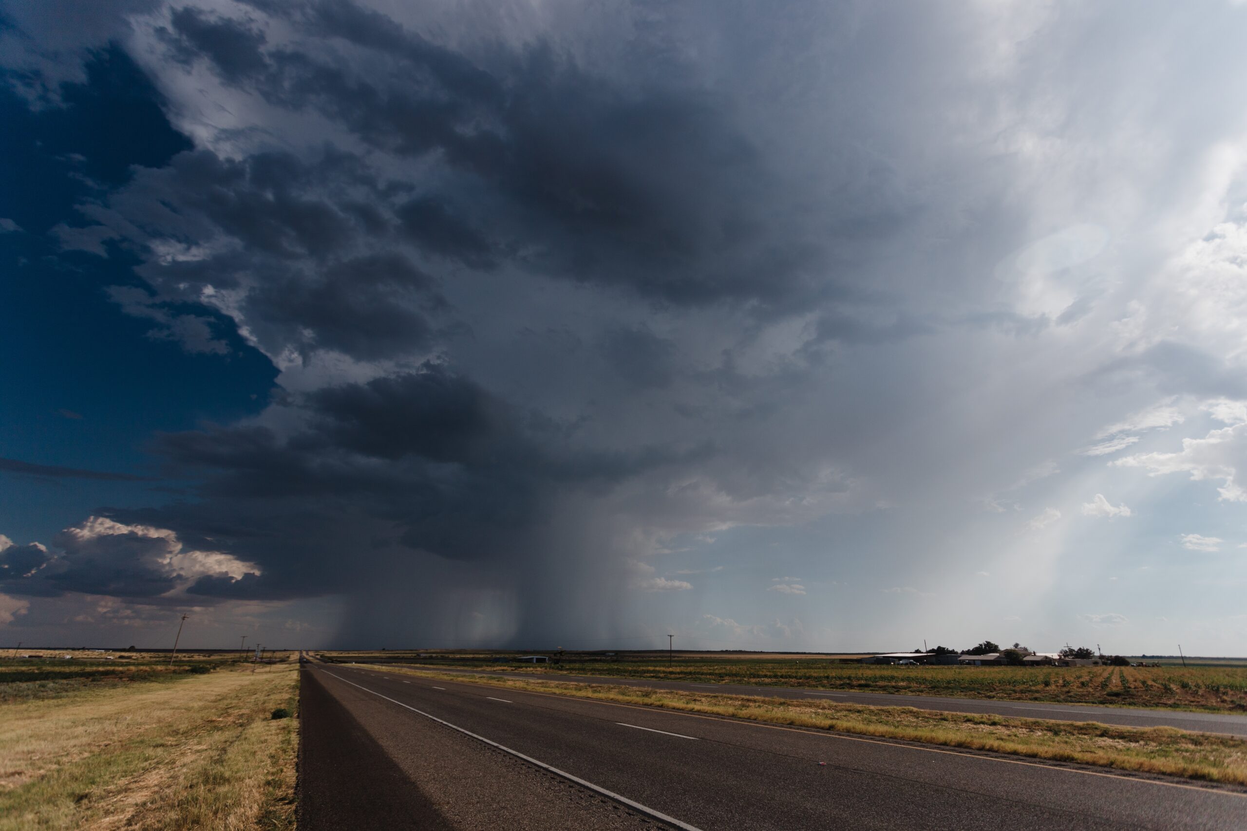
California Heavy Precipitation Event ↑
- Location: California, U.S.A.
- Sustax Climate Variable: Daily Accumulated Total Precipitation
- Time Period: December and January 2022/23
In early 2023, California was struck by a series of powerful atmospheric river storms that brought historic rainfall and snowfall across the state. Between December 2022 and January 2023, successive systems produced widespread flooding, landslides, and infrastructure damage. This extraordinary sequence ranks among the most significant wet seasons in California’s modern record. Sustax predicted an elevated likelihood of extreme winter precipitation. Its forecasts, based on the monthly maximum of daily precipitation, indicated percentiles well above historical averages, closely matching both the intensity and timing of the conditions that ultimately unfolded during the 2022–2023 winter. These results underscore the platform’s predictive skill for extreme precipitation events.

To better capture the cumulative nature of the California storms, the analysis was extended to use the monthly maximum of weekly accumulated rainfall. This approach reflects the prolonged and repeated nature of the atmospheric river systems more accurately than single-day extremes. The resulting data show exceptionally high precipitation percentiles across nearly all scenarios, with two reaching the 100th percentile, highlighting the unprecedented intensity of the 2022–2023 winter season. The consistently elevated percentiles across all Sustax scenarios elude to the model’s capability to also predict periods of sustained, extreme precipitation. These results align closely with the observed record-breaking rainfall and snowfall across California during several days, emphasising both the model’s predictive reliability and the severity of the winter conditions that unfolded.

Brazil Heavy Precipitation Event ↑
- Location: Rio Grande do Sul (Southern Brazil)
- Sustax Climate Variable: Daily Accumulated Total Precipitation
- Time Period: April and May 2024
In April and May 2024, Southern Brazil experienced one of the most severe rainfall and flooding events in recent decades, leading to extensive humanitarian, economic, and environmental consequences. Sustax shows a consistent predictive signal across nearly all scenarios for heavy precipitation around May 2024, aligning closely with the timing of the observed flooding. Although the signal is somewhat weaker than for other events, this is due to the storm’s prolonged nature rather than a single intense rainfall episode.
Most SSP scenarios indicate a clear rise in monthly precipitation percentiles during this period, showing that the model captured the onset of extreme conditions. Due to this specific flooding developing over an extended 10-day period rather than a single intense day, analyses based on daily extremes display lower percentiles than other storms in this report. Nevertheless, the model still identifies a distinct signal of anomalously high rainfall around May 2024, that warrants further investigation.

To better reflect the storm’s actual duration and cumulative impact, a bimonthly accumulated rainfall metric was calculated for the same period, with the monthly maxima of these values presented below. This method smooths out short-term fluctuations and provides a clearer picture of sustained heavy rainfall events, such as the one observed in southern Brazil. By aggregating rainfall over a two-week timescale, the analysis captures the prolonged nature of the event more effectively than daily extremes alone. The resulting distribution shows noticeably higher percentiles for this period, with one scenario even predicting the highest two-week rainfall event over the last 50 years, further emphasising the model’s capacity to detect significant, persistent precipitation episodes.

Valencia Extreme Precipitation Event ↑
- Location: Utiel – Requena, Valencia
- Sustax Climate Variable: Daily Accumulated Total Precipitation
- Time Period: October 2024
On October 2024, a catastrophic DANA (isolated high-altitude depression) unleashed torrential rain on Spain, with the Utiel-Requena region among the most severely affected. The downstream impacts were devastating for the city of Valencia, resulting in over 230 fatalities and economic losses exceeding €1.14 billion, according to the Spanish Government. To evaluate Sustax’s performance for this event, a separate analysis was conducted using daily precipitation data spanning 1979–2080, allowing direct comparison of individual extreme rainfall events across the full record.
Within this framework, the Sustax SSP4-3.4 scenario predicted an exceptional precipitation event for Utiel on 22 September 2024, approximately one month before the actual storm occurred. This forecasted event exceeds all other modeled daily extremes in the 100-year dataset by an extraordinary 40 percent margin compared to the next highest event, emphasising both the unprecedented magnitude and the early predictive capability of the model. Such a pronounced anomaly demonstrates Sustax’s potential to anticipate record-breaking precipitation events with significant lead time. The graph below illustrates this finding within the long-term daily precipitation context, clearly showing the statistical separation of the October 2024 event from historical variability.
Reports differ between this event from 1 in 100 year event to a 1 in 500 year event. The model approximately displayed a 1 in 200 year event which fits in this range. The reader must consider the events are taken on a pixel level of 25 degrees.

Storm Eowyn and Storm Darragh of the British Isles ↑
- Location: Cork (Ireland), Isle of Man (United Kingdom), York (United Kingdom)
- Sustax Climate Variable: 10 metre Maximum Wind Gust
- Time Period: December-2024 and January-2025
Storms Darragh and Eowyn were severe windstorms that impacted Ireland, the Isle of Man, and the United Kingdom. Darragh struck in December 2024, and Eowyn followed in January 2025, both bringing strong winds and widespread damage. Red weather warnings were issued for both events.

The December 2024–January 2025 period over Cork stands out for exceptionally strong wind activity relative to the 1979–2025 climatology. Monthly percentiles of maximum wind gusts for both December and January approach the 100th percentile across numerous scenarios, underscoring the intensity of Storm Darragh as it approached from the North Atlantic. The strongest anomalies coincide with the storm’s rapid deepening west of Ireland, which generated intense southwesterly flow and widespread coastal gusts. Illustrating Cork’s exposure to the early phases of deep low-pressure systems that typically make first landfall along Ireland’s southern and western coasts.

Across the Isle of Man, the gust percentile record reveals a two-stage response associated with the passage of Storms Darragh and Eowyn, with multiple scenarios showing dual peaks near the 100th percentile within a short period. The first peak corresponds to Darragh’s frontal system, which produced strong, turbulent conditions across the central Irish Sea. The second peak, in early 2025, coincides with Storm Eowyn as it moved eastward across the region. Relative to the 1979–2025 baseline, these back-to-back extremes place winter 2024–25 among the most intense wind seasons on record for the island, reflecting its position along the principal North Atlantic storm-track corridor between Ireland and northern England.

Over York and northern England, gust activity displays two less pronounced peaks compared with Cork and the Isle of Man, reflecting the region’s more peripheral position relative to the storm cores. These peaks correspond first to Storm Darragh and later to Storm Eowyn. This progression highlights the north eastward evolution of the Atlantic storm track, with Eowyn delivering the most significant inland gusts toward the end of the season.

Conclusions ↑
Across multiple regions and event types, Sustax demonstrated strong skill in anticipating the timing, magnitude, and time-span of extreme weather events during the predictive period from 2023 to 2025. Its accurate identification of high-impact precipitation, wind, and temperature extremes highlights the model’s versatility across diverse climatic regimes and hazard types. Although not all scenarios fully captured each event, the multi-scenario approach consistently produced reliable signals indicating the potential for extreme conditions, setting up the first pillar for predictive extreme events analysis.
Beyond reproducing the temporal alignment of these extremes, Sustax effectively represented the relative severity of each event within its long-term climatological context, including cases where predictions exceeded historical maxima, demonstrating the system’s extrapolation capability despite using recalibrated (i.e. post-processed) scenarios. These findings highlight the platform’s strength in detecting and predicting anomalous meteorological behaviour beyond established climatological norms.
We must highlight that this report includes a proactive decision-support framework to identify and quantify extreme events, special mention for the case of precipitation where monthly-maxima was complemented with weekly accumulated. By integrating such framework into infrastructure design, disaster preparedness, and resource allocation, the model offers a forward-looking, evidence-based foundation for adaptation strategies in the face of increasing climate volatility.
This validation report represents a transparency and validation exercise to demonstrate how Sustax climate projections respond to observed extreme weather events during the predictive period. It is important to note that:
- Sustax does not offer weather forecasts. Sustax’s available climate projections are based on ensemble climate modelling under CMIP6 framework, not not on short term weather forecasts. Climate models simulate the statistical behaviour of the climate system and represent plausible future states under different forcing scenarios, rather than forecasting the exact timing, location, or magnitude of individual extreme events.
- Not all extreme events can be captured by ANY climate model/s nor by Sustax. As established by leading institutions including ECMWF and NOAA, climate models are subject to inherent limitations stemming from atmospheric chaos, model resolution constraints, and (most importantly in our experience) the stochastic nature of weather variability. NOAA emphasises that “chaos imposes limitation on the accuracy of the prediction of instantaneous state of the weather system”, this uncertainty increases in long-term climate projections.
This analysis presents extreme events that materialised within Sustax predictive period to validate the model’s ability to represent realistic climate variability and extreme event characteristics. Sustax climate models are the result of the statistical combination of different climate models obtained from 3rd parties institutions working under CMIP6 framework (see: Your Reliable Climate Data for Climate Adaptation with Sustax) and Geoskop’s algorithms (see: Climate offering – refined CMIP6 (1979-2080) and ERA5 – Sustax).
The user must be aware data provided from these models could be inaccurate, negatively affecting the quality of Geoskop’s refining step and Sustax output models. Geoskop is committed to advise the user on the risks and interpretations of its climate models, yet the outputs delivered to the client must be used and interpreted under client responsibility, taking into account that local weather may differ from the projections provided by Geoskop given the circumstances described above. Geoskop shall not be liable for any damages incurred as a result of the use of its models.